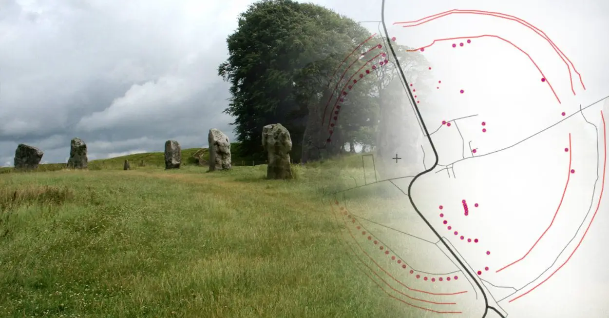
The landscape of the Avebury Stone Circle is a World Heritage Site, located in the county of Wiltshire, England.
The area was designated part of the Stonehenge, Avebury and Associated Sites by UNESCO in 1986, in recognition for one of the most architecturally sophisticated stone circles in the world, in addition to the rich Neolithic, and Bronze age remains, such as the West Kennet Avenue, Beckhampton Avenue, West Kennet Long Barrow, the Sanctuary, and Windmill Hill.
The Avebury Stone Circle Landscape – To View Full Map – Click Here
Avebury Stone Circle
Avebury is the largest megalithic stone circle in the world, consisting of a large henge with an outer circle of stones, and two smaller stone circles situated in the centre of the monument.
It is the result of many phases of construction during late prehistory, with the earliest phase dating from the middle of the third millennium BC. Around this time, a large henge was constructed spanning over 1,000 metres in diameter, consisting of a large circular bank with an internal ditch.
The following sequence of phases is unclear, but an outer ring of sarsen standing stones (believed to be between 98 to 105) was added around 2870–2200 BC. In the centre of the henge, two additional rings of stones were aligned more or less north and south, and ceremonial avenues were added that connected Avebury to other megalithic monuments nearby.
West Kennet Avenue
West Kennet Avenue, also called Kennet Avenue is a ceremonial causeway bordered by a parallel line of stones between the Avebury and Sanctuary Stone Circles. Up to 100 pairs of stones were erected along the avenue, creating a corridor 15 metres wide that runs for 1.5 miles.
The Sanctuary
The Sanctuary was a stone and timber circle erected on Overton Hill, connected to the Avebury Stone Circle by the West Kennet Avenue.
The earliest phase of the monument dates from around 3000 BC, consisting of a ring of wooden posts and a central post (possibly a round hut). This was enlarged with consecutive rings of wooden posts, and an inner stone circle of 15 or 16 sarsen stones.
The wooden posts were later replaced with a boundary ring of 42 sarsen stones around the same time as the construction of Avebury, reaching a total diameter of 40 metres in width.
Silbury Hill
Silbury Hill is a man-made conical mound that stands at a height of 31 metres above the Avebury landscape. The hill was built in several phases by successive generations of the late Neolithic to early Bronze Age Britons from 2470 to 2350 BC.
The earliest phase consisted of a 1-metre-tall mound core, with a gravel and revetting kerb of stakes and sarsen boulders. Further mounds were then constructed on the core, raising the height of the monument with complex layers of chalk and clay.
The function of Silbury Hill has eluded archaeologists for centuries, with theories ranging from a ceremonial platform for an elite priesthood, seasonal rituals, a system of inter-related sightlines to other prehistoric monuments, or the burial site of King Sil told in local folklore.
Windmill Hill
Windmill Hill is a ’causewayed enclosure’, with three concentric but intermittent ditches. The construction of the enclosure has been dated to around 3675 BC and remained in use until around 2500 BC. A type of Neolithic pottery first found on Windmill Hill has also been identified in sites across Wessex and has hence taken the name of the site: Windmill Hill type pottery.
West Kennet Long Barrow
West Kennet Long Barrow, also called the South Long Barrow is a chambered long barrow, a localised regional variant of barrows in Western Britain, now known as the Cotswold-Severn Group. Burials recovered from the chambers suggest the monument was constructed around 3670 and 3635 BC and remained in use for burial as late as 3240 BC.
Beckhampton Avenue
The Beckhampton Avenue was a ceremonial causeway bordered by a parallel line of stones that connected to the Avebury Stone Circle. The avenue consisted of a double row of stones placed at 15 m intervals in a similar pattern to those at Kennet Avenue, although only a single stone called the “Adam Stone” now survives.
Falkner’s Circle
Falkner’s Circle is the remains of a stone circle a short distance from the Avebury Stone Circle. The Falkner’s Circle had a diameter of 36.6 metres and consisted of twelve sarsen stones (only one stone survives), which archaeologists suggest were erected close to where they were naturally found.
The Devil’s Den
The Devil’s Den is the remains of a dolmen burial chamber that marks the entrance of a Neolithic passage grave on Fyfield Down. The dolmen was named after the devil, where according to tradition a demon would drink from the hollows on the capstone at night.
The Longstones
The Longstones, also called the Adam & Eve Stones, are two sarsen stones which may have formed part of the Beckhampton Avenue that connected with the Avebury Stone Circle. Adam is the larger of the two stones, and also formed a cove with other three nonextant stones.
Header Image Credit : Public Domain
