1 – Pavlopetri
Pavlopetri, also called Paulopetri, is a submerged ancient town, located between the islet of Pavlopetri and the Pounta coast of Laconia, on the Peloponnese peninsula in southern Greece.
Ceramics recovered in situ confirms that Pavlopetri had Mycenaean occupation, but further archaeological evidence suggests that the town was occupied as early as 3500 BC. Geologists theorise that the submergence of the town was the result of local and regional faulting of the Cretan Arc (an arcuate mountain chain of the southern Aegean Sea), that led to the convergence and subduction of the tectonic plate causing the town to drop beneath the sea level.
2 – Olous
Olous, also called Olus is an ancient Dorian city that lies on both sides of the isthmus that connects the peninsula of Spinalonga to the mainland in the modern-day town of Elounda in Crete. The earliest evidence for a settlement dates from the archaic period from the eighth century BC to the second Persian invasion of Greece in 480 BC, with some earlier Minoan tombs in the wider area.
Researchers believe that the city was submerged due to a local shift caused by an earthquake sometime around the 2nd century AD.
3 – Baiae
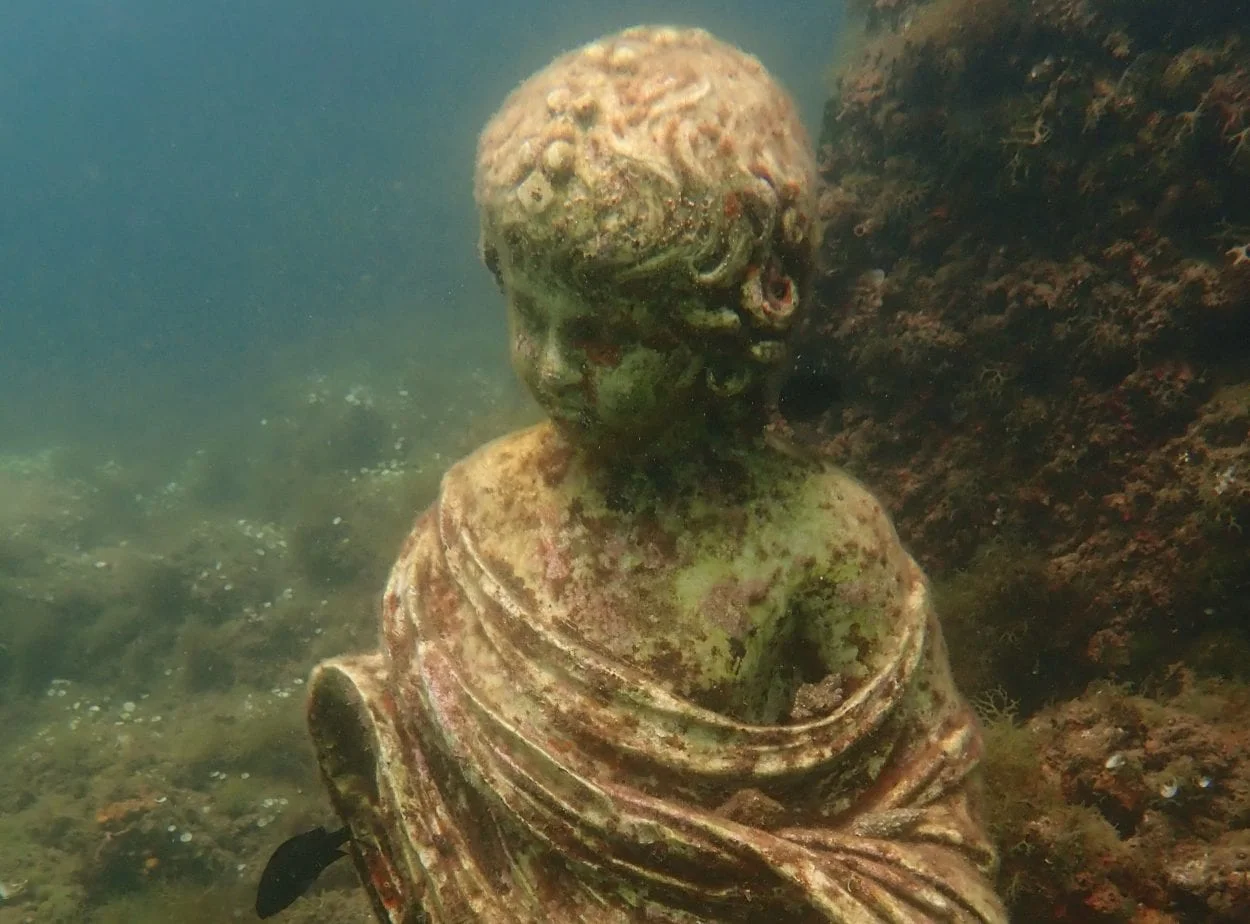
Baiae is a partially sunken Roman town, located on the shore of the Gulf of Naples in the present-day comune of Bacoli in Italy. The earliest accounts mentioning the town dates from 178 BC under the name of Aquae Cumanae. The settlement developed into a popular Roman resort, earning a reputation for a hedonistic lifestyle, even being described as a “vortex of luxury” and a “harbour of vice”.
The town became partially submerged due to local volcanic bradyseismic activity, raising and lowering the geology of the landmass around the Gulf of Pozzuoli in the 8th century AD.
4 – Port Royal
Port Royal, originally named Cagway, was an English harbour town and a notorious base for buccaneers and privateers during the 17th century AD.
By the 1660’s, Port Royal had gained a reputation as the “Sodom of the New World”, serving as the home port for pirates such as Christopher Myngs, Henry Morgan, Roche Brasiliano, John Davis, and Edward Mansvelt. In 1692, Jamaica was hit by a large earthquake, causing the land under Port Royal to liquefy, with a successive tsunami submerging many of the town’s buildings beneath the Cagway Bay.
5 – Dunwich
Dunwich was a major trading port and town on the east coast of Suffolk England, that grew in size and status to match London during the 13th century AD. The town boasted eight churches, three chapels, five houses of religious orders (including Franciscan and Dominican monasteries), a preceptory of the Knights Templar, two hospitals, and a guildhall.
In 1286, Dunwich was struck by a massive storm surge, and successive storm systems that eroded the coastline, resulting in the loss of the town’s harbour causing an economic collapse for the inhabitants. Over the centuries, long-shore drift erosion swallowed the remainder of the town beneath the sea (albeit the ruins of the Greyfriars Franciscan friary and the Chapel of St James’ Leper Hospital that still survive).
6 – Ravenser Odd
Ravenser Odd, also called Ravensrodd, was a port town in the East Riding of Yorkshire, England on the sandbanks of the Spurn heritage coast in the Humber estuary.
The town was founded around AD 1235, having grown rapidly through the act of forestalling merchant shipping bound for Hull. The town gradually succumbed to coastal erosion, having become fully submerged during the Mandrenke storm (also known as Saint Marcellus’s flood) in 1362.
7 – Dolchiste
Dolchiste, also called Dolikisthe, was a Byzantine town located on the island of Kekova in present-day Turkey. The town was destroyed during an earthquake in the 2nd century AD, resulting in a lowering of the islands geology that submerged half of the towns structures, including a port, a basilica church, and various town houses.
8 – Atlit-Yam
Atlit-Yam is a Neolithic settlement located in the Bay of Atlit off the Carmel coast in present-day Israel.
The settlement covered an area of 9.8 acres and consisted of rectangular houses, hearth-places, a well, and a stone circle that dates from around 7000 BC during the Pre-Pottery Neolithic. Studies by the Italian National Institute of Geophysics and Volcanology in Pisa suggests that a volcanic collapse of the eastern flank of Mount Etna may have caused a tsunami resulting in the settlement being submerged.
9 – Heracleion
Heracleion, also known as Thonis was an ancient Egyptian city located near the Canopic Mouth of the Nile in present-day Egypt.
The earliest mention of the city dates from around the 12th century BC, having been described by many chroniclers in antiquity, including Herodotus, Strabo and Diodorus. The city was constructed on adjoining islands in the Nile Delta, emerging as a major trading port during the Late Period of ancient Egypt. During the end of the 2nd century BC, a combination of earthquakes, tsunamis, rising sea levels and soil liquefaction resulted in Heracleion being submerged along with the adjacent population centres of Canopus and Menouthis.
10 – Doggerland
Doggerland is a submerged land mass beneath what is now the North Sea, that once connected Britain to continental Europe. The landscape was a diverse mix of gentle hills, marshes, wooded valleys, and swamps. Mesolithic people settled in the region and took advantage of Doggerland’s rich migrating wildlife and seasonal hunting grounds.
Over time, the area was flooded by rising sea levels after the last glacial period around 6,500 to 6,200 BC. Melting water that had been locked away caused the land to tilt in an isostatic adjustment as the huge weight of ice lessened. Doggerland eventually became submerged leaving only Dogger Bank, a possible moraine (accumulation of glacial debris) which also succumbed to the sea around 5000BC.
Header Image Credit : Holly Lewis – Shutterstock
